COMPLEX DATA MANAGEMENT / CONVERSION
|
<Click images below to see full size slide> |
|
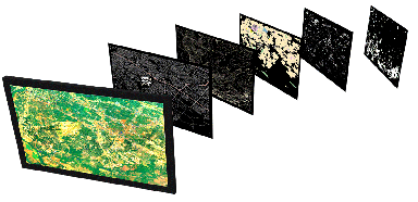
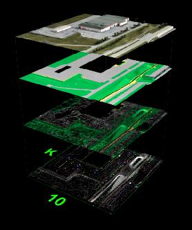
It was an education for many private clients and public agencies over the years when they would learn how I would resourcefully put all of their GIS resource to good use. ...a new use
I created and used illustrations like the video below to help explain how their GIS assets would now become a powerful marketing, decision making, public information resource.
|
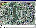
When working on extremely sophisticated simulations involving both outdoor and interior 3D datasets & libraries, version control and multiple fidelities (LODs) of each model must be managed efficiently.
|
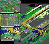
When receiving data from the multiple areas of engineering disciplines I have worked with; you must understand the need to geospatially coordinate each model's reference files; and accurately rectify all data being utilized within the simulated environment; regardless of the format (or lacking coordination) it was originally delivered in.
|
A great deal of explanations are always offered to any client in order to express the importance of obtaining the best available datasets. While at the same time remaining flexible and understanding to the fact that few institutions to this day maintain anywhere close to 100% data quality, compatibility or coordination.
|
|